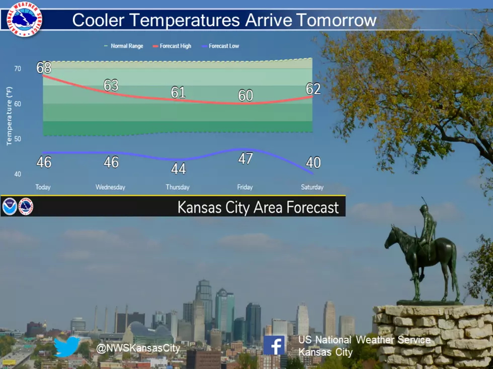
Temporary Flip-Flops Hiatus…Grab the Jacket
Cooler temperatures will move into the area Starting tomorrow, making it feel more like early April than May. For now, summer temperatures will hold off until at least mid May.
Here's the forecast for the Sedalia/Whiteman AFB/Warrensburg area according to the National Weather Service:
TodayPartly sunny, with a high near 67. Breezy, with a west northwest wind 8 to 13 mph increasing to 16 to 21 mph in the afternoon. Winds could gust as high as 36 mph.TonightA slight chance of showers after 4am. Increasing clouds, with a low around 43. North northwest wind 13 to 18 mph becoming light. Winds could gust as high as 29 mph. Chance of precipitation is 20%.WednesdayA slight chance of showers before 7am. Mostly sunny, with a high near 63. Light northwest wind becoming north northwest 5 to 9 mph in the morning. Chance of precipitation is 10%.Wednesday NightPartly cloudy, with a low around 43. North wind around 6 mph becoming calm in the evening.ThursdayA chance of rain after 1pm. Increasing clouds, with a high near 64. Light south southwest wind. Chance of precipitation is 40%. New precipitation amounts of less than a tenth of an inch possible.Thursday NightRain likely, mainly before 1am. Cloudy, with a low around 45. Chance of precipitation is 60%. New precipitation amounts between a half and three quarters of an inch possible.FridayMostly sunny, with a high near 59.Friday NightClear, with a low around 36.SaturdaySunny, with a high near 64.Saturday NightMostly cloudy, with a low around 46.SundayPartly sunny, with a high near 64.Sunday NightPartly cloudy, with a low around 41.MondayA chance of rain. Mostly sunny, with a high near 62. Chance of precipitation is 30%.

More From Mix 92.3